October 26th
TRACKER MAP
KATRIN - OCTOBER 26th
https://www.google.com/maps/d/edit?mid= ... sp=sharing
Total distance flown: 99.2 km
Battery level: 100%
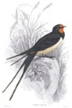
Today, little
Katrin flew to the island Lesbos, and is near Polichnitos and the Gulf of Kalloni !

So Katrin is
in Greece now!
 Lesbos
 lies in the far east of the Aegean sea, facing the Turkish coast (Gulf of Edremit) from the north and east; at the narrowest point, the strait is about 5.5 km wide. The shape of the island is roughly triangular, but it is deeply intruded by the
gulf of Kalloni, with an entry on the southern coast, and the
gulf of Gera, in the southeast.
The island is forested and mountainous with two large peaks,
Mount Lepetymnos at 968 m and
Mount Olympus at 967 m — not to be confused with Mount Olympus in Thessaly on the Greek mainland, ancient "home of the gods" and one of four so-named mountains in Greece— dominating its northern and central sections. The island's volcanic origin is manifested in
several hot springs and the two gulfs.
Lesbos is verdant, aptly named Emerald Island, with a greater variety of flora than expected for the island's size. Eleven million olive trees cover 40% of the island together with other fruit trees. Forests of mediterranean pines, chestnut trees and some oaks occupy 20%, and the remainder is scrub, grassland or urban.
The island has a
hot-summer Mediterranean climate. The mean annual temperature is 18 °C, and the mean annual rainfall is 750 mm. Its exceptional sunshine makes it one of the sunniest islands in the Aegean Sea. Snow and very low temperatures are rare.
Polichnitos is a little town and a former municipality on the island of Lesbos, North Aegean, Greece. Since the 2019 local government reform it is part of the municipality West Lesbos, of which it is a municipal unit. Population 4,234 (2001). The municipal unit is located in the central south coast of the island, adjacent to the south side of the Bay of Kalloni. It has a land area of 172.629 km2. Its municipal seat is in the town of Polichnítos. The next largest villages are Vrísa (617), Vasiliká (400), and Lisvóri (408).


Between 15:35 and 18:25 little Katrin was fishing in the Polichnitos salt pans.