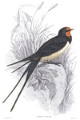
Following Karls' Families
- Anne7
- Registered user
- Posts: 10582
- Joined: April 15th, 2016, 3:26 pm
- Location: Belgium
Re: Following Karls' Families
May 27th
Hello everyone
WABA
▶︎ TRACKER MAP
WABA 26.05 - 27.05.2023
From 26.05 at 10:36 UTC until 27.05 at 11:07 UTC
https://www.google.com/maps/d/edit?mid= ... sp=sharing
Distance: 141 km
Battery: 100 %
Waba is at about 20 km from the Hungarian border, in flight at 1 km/h, a little southeast of Chișineu-Criș.
The town Chișineu-Criș is situated on the north-western side of the county, at a 43 km distance from Arad, the county seat.
The administrative territory stretches over 119 km2 on the Crișul Alb Plateau, on both sides of the river Crișul Alb.
The Crișul Alb (Romanian), (Hungarian: Fehér-Körös) is a river in western Romania, in the historical region of Transylvania, and in south-eastern Hungary (Békés County).
Its source is in the southern Apuseni Mountains. It flows through the towns Brad, Ineu, Chișineu-Criș in Romania, and Gyula in Hungary. Crossing the border of Hungary, the river, now called Fehér-Körös, joins the Fekete-Körös (Crișul Negru) a few kilometres north from Gyula to form the river Körös (Criș) which ultimately flows into the Danube. In Romania, its length is 234 km and its basin size is 4,240 km2.
“Clearly, animals know more than we think, and think a great deal more than we know.”
— Irene Pepperberg
— Irene Pepperberg
- Anne7
- Registered user
- Posts: 10582
- Joined: April 15th, 2016, 3:26 pm
- Location: Belgium
.
Yesterday 26.05 around 13:45 UTC+3, Waba crossed the Mureș river near the village of Mintia.
Mintia is a village in Hunedoara province with a population of about 807. It is close to the villages of Bejan and Păuliș.
A view of Mintia, the river Mureș and its wide surroundings
© Calin Alba
The Mintia-Deva power plant is Romania's third largest thermal power plant
The Mintia-Deva power plant
© Calin Alba
The Mureș is a 789-kilometre-long river in Eastern Europe. Its basin covers an area of 30,332 km². It rises in the Hășmașu Mare mountains in the Eastern Carpathians, Romania, close to the headwaters of the Olt River, and flows into the Tisza near Szeged in southeastern Hungary.
Moments later, Waba flew over the water bodies of Bejan-Târnăvița.
https://up.picr.de/45727274bs.png
© D. Parachiv
“Clearly, animals know more than we think, and think a great deal more than we know.”
— Irene Pepperberg
— Irene Pepperberg
- Anne7
- Registered user
- Posts: 10582
- Joined: April 15th, 2016, 3:26 pm
- Location: Belgium
.
Yesterday, Waba continued his/her journey westward along the Mureș river.
This is where Waba spent the night of May 26-27, just south of the river in what appears to be wet terrain, near Nicolae Bălcescu, a village in Arad County, Romania.
Arad County is an administrative division (judeţ) of Romania roughly translated into county in the western part of the country on the border with Hungary, mostly in the region of Crișana and a few villages in Banat.
A view of that wider area
© Ádám Horváth
“Clearly, animals know more than we think, and think a great deal more than we know.”
— Irene Pepperberg
— Irene Pepperberg
- Anne7
- Registered user
- Posts: 10582
- Joined: April 15th, 2016, 3:26 pm
- Location: Belgium
.
Today, Waba continued his/her journey in northwestern direction.
Waba's current area
Looks like Waba is taking a break (on a brooklet?) in a forest near the river Crișul Alb.
Aerial view of Chișineu-Criș
https://goo.gl/maps/cjdahtFpGF3BakbHA
The Crișul Alb River near Chișineu-Criș
https://goo.gl/maps/4BymWL9dR2pq3eF96
Enjoy a cosy Whitsun weekend.
“Clearly, animals know more than we think, and think a great deal more than we know.”
— Irene Pepperberg
— Irene Pepperberg
- Anne7
- Registered user
- Posts: 10582
- Joined: April 15th, 2016, 3:26 pm
- Location: Belgium
Hulbi, I wish you and your family member all the best and lots of courage.
“Clearly, animals know more than we think, and think a great deal more than we know.”
— Irene Pepperberg
— Irene Pepperberg
-
- Registered user
- Posts: 495
- Joined: August 3rd, 2022, 9:41 am
Thanks a lot, Anne!
- Bea
- Moderator
- Posts: 28724
- Joined: January 15th, 2011, 1:02 pm
- Location: Bavaria, Germany
☼ ☼
Hello everyone!
BONUS
▶︎ TRACKER MAP
BONUS 26.05. - 27.05.2023
From 26.05._17:06 until 27.05._17:05
https://www.google.com/maps/d/edit?mid= ... sp=sharing
Battery: 100%
Distance: 26,4 km
Bonus is still in Turkey, same place like all the days before, east of Karacaören
Hello everyone!
BONUS
▶︎ TRACKER MAP
BONUS 26.05. - 27.05.2023
From 26.05._17:06 until 27.05._17:05
https://www.google.com/maps/d/edit?mid= ... sp=sharing
Battery: 100%
Distance: 26,4 km
Bonus is still in Turkey, same place like all the days before, east of Karacaören
Nature does nothing in vain (Aristoteles)
- Bea
- Moderator
- Posts: 28724
- Joined: January 15th, 2011, 1:02 pm
- Location: Bavaria, Germany
☼ ☼
WABA
Hello everyone
▶︎ TRACKER MAP
WABA 26.05. - 28.05.2023
From 27.05._11:07 until 28.05._11:08
https://www.google.com/maps/d/edit?mid= ... sp=sharing
Distance: 183 km
Battery: 100 %
Waba has changed countries - has left Romania and is in Hungary now
Last data show Waba near the city Gyomaendröd ....
... not far from nice meandering river Körös in a field
Have a nice Sunday everyone and happy Pentecost to all who celebrate it
Nature does nothing in vain (Aristoteles)
- Francesca_V
- Registered user
- Posts: 1830
- Joined: August 11th, 2012, 10:19 pm
- Location: Germany
wow!
If he keeps going in this direction, he will eventually arrive at the Baltic Sea in Poland!
- Bea
- Moderator
- Posts: 28724
- Joined: January 15th, 2011, 1:02 pm
- Location: Bavaria, Germany
☼ ☼
Who knows?
It´s so fascinating to watch these youngsters travelling around after their first winter away from home
Who knows?
It´s so fascinating to watch these youngsters travelling around after their first winter away from home
Nature does nothing in vain (Aristoteles)
- Bea
- Moderator
- Posts: 28724
- Joined: January 15th, 2011, 1:02 pm
- Location: Bavaria, Germany
☼ ☼
Hello everyone!
BONUS
▶︎ TRACKER MAP
BONUS 27.05. - 28.05.2023
From 27.05._17:05 until 28.05._17:04
https://www.google.com/maps/d/edit?mid= ... sp=sharing
Battery: 100%
Distance: 13,2 km
No breaking news from Bonus, still in Turkey between Karacaören and Ahiler
Hello everyone!
BONUS
▶︎ TRACKER MAP
BONUS 27.05. - 28.05.2023
From 27.05._17:05 until 28.05._17:04
https://www.google.com/maps/d/edit?mid= ... sp=sharing
Battery: 100%
Distance: 13,2 km
No breaking news from Bonus, still in Turkey between Karacaören and Ahiler
Nature does nothing in vain (Aristoteles)
- Anne7
- Registered user
- Posts: 10582
- Joined: April 15th, 2016, 3:26 pm
- Location: Belgium
May 29th
WABA
Hi everyone
▶︎ TRACKER MAP
WABA 28.05 - 29.05.2023
From 28.05 at 11:08 UTC until 29.05 at 11:08 UTC
https://www.google.com/maps/d/edit?mid= ... sp=sharing
Distance: 41.1 km
Battery: 100 %
Yesterday afternoon Waba continued to fly westwards along the river Körös (or Criș).
The Körös (Hungarian) or Criș (Romanian) is a river in eastern Hungary and western Romania. Its length is 128.6 km from the confluence of its two source rivers Fehér-Körös (Crișul Alb) and Fekete-Körös (Crișul Negru) to its outflow into the Tisza. Its drainage basin area is 27,537 km2. It has three source rivers, all of which have their origin in the Apuseni Mountains in Transylvania, Romania: Crișul Alb (Fehér-Körös), Crișul Negru (Fekete-Körös) and Crișul Repede (Sebes-Körös).
Waba spent the night south of Mezőtúr.
It seems to be a beautiful and water-rich area.
Mezőtúr is a town in Jász-Nagykun-Szolnok county.
It lies in the centre of the Great Hungarian Plain, on the banks of the Hortobágy-Berettyó
The Hortobágy-Berettyó is an artificial watercourse on the border of the counties of Békés and Jász-Nagykun-Szolnok. The main channel is essentially the lower section of the Hortobágy River south of the Ágota mound, extending to the mouth.
Today Waba flew a little further west along the river Körös, and is currently slightly east of Békésszentandrás.
Békésszentandrás is a village in Békés county, in the Southern Great Plain region of south-east Hungary.
Békésszentandrás, the western gate of Békés county, lies along the left bank of the Hármas-Körös River.
The area has many prehistoric tumuli, known locally as kunhalom ('Cumanian Barrow'). The largest is Gödény-halom with a height of over 12 metres.
Night (and feeding) area
“Clearly, animals know more than we think, and think a great deal more than we know.”
— Irene Pepperberg
— Irene Pepperberg
- Anne7
- Registered user
- Posts: 10582
- Joined: April 15th, 2016, 3:26 pm
- Location: Belgium
.
A few images of Waba's wider night area
The Hortobágy-Berettyó
The river Körös in Waba's area
A few images of Waba's wider night area
The Hortobágy-Berettyó
The river Körös in Waba's area
“Clearly, animals know more than we think, and think a great deal more than we know.”
— Irene Pepperberg
— Irene Pepperberg
- Anne7
- Registered user
- Posts: 10582
- Joined: April 15th, 2016, 3:26 pm
- Location: Belgium
.
Waba's last shown area.
West of Waba's location appears to be a large (fish?)pond complex.
Is it some kind of fishing resort?
Edit: apparently it is a combined (experimental) intensive-extensive fishpond system developed for the purification and re-use of intensive fishpond effluent water.
https://www.researchgate.net/publicatio ... ion_system
Halastavak means fishpond in Hungarian.
“Clearly, animals know more than we think, and think a great deal more than we know.”
— Irene Pepperberg
— Irene Pepperberg
- Anne7
- Registered user
- Posts: 10582
- Joined: April 15th, 2016, 3:26 pm
- Location: Belgium
Good evening
BONUS
▶︎ TRACKER MAP
BONUS 28.05 - 29.05.2023
From 28.05 at 17:04 UTC until 29.05 at 17:04 UTC
https://www.google.com/maps/d/edit?mid= ... sp=sharing
Battery: 100%
Distance: 9.89 km
Bonus is still in the same area, between the villages Çöğürler, Karacaören, Çavuşçiftliği and Ahiler in the Kütahya Province in Turkey
“Clearly, animals know more than we think, and think a great deal more than we know.”
— Irene Pepperberg
— Irene Pepperberg
- Bea
- Moderator
- Posts: 28724
- Joined: January 15th, 2011, 1:02 pm
- Location: Bavaria, Germany
☼ ☼
WABA
Hello everyone
▶︎ TRACKER MAP
WABA 29.05. - 30.05.2023
From 29.05._11:08 until 30.05._11:08
https://www.google.com/maps/d/edit?mid= ... sp=sharing
Distance: 20 km
Battery: 100 %
Waba is still in Hungary, north of Szarvas and still in vicinity of river Körös
WABA
Hello everyone
▶︎ TRACKER MAP
WABA 29.05. - 30.05.2023
From 29.05._11:08 until 30.05._11:08
https://www.google.com/maps/d/edit?mid= ... sp=sharing
Distance: 20 km
Battery: 100 %
Waba is still in Hungary, north of Szarvas and still in vicinity of river Körös
Nature does nothing in vain (Aristoteles)
- juta
- Site Admin
- Posts: 5732
- Joined: September 25th, 2008, 1:52 pm
- Location: Tallinn, Estonia
Good evening!
BONUS
Tracker map 29.05 - 30.05.2023
Route 7.77 km
Battery 100%
Bonus is flying around its summer place!
https://www.google.com/maps/d/edit?mid= ... sp=sharing
So many points!
BONUS
Tracker map 29.05 - 30.05.2023
Route 7.77 km
Battery 100%
Bonus is flying around its summer place!
https://www.google.com/maps/d/edit?mid= ... sp=sharing
So many points!
Proud member of SHoW (StorkaHolics of the World)
- Francesca_V
- Registered user
- Posts: 1830
- Joined: August 11th, 2012, 10:19 pm
- Location: Germany
This must be a wonderful place for our Bonus!
- Anne7
- Registered user
- Posts: 10582
- Joined: April 15th, 2016, 3:26 pm
- Location: Belgium
May 31st
WABA
Hello everyone
▶︎ TRACKER MAP
WABA 30.05 - 31.05.2023
From 30.05 at 11:08 UTC until 31.05 at 11:07 UTC
https://www.google.com/maps/d/edit?mid= ... sp=sharing
Distance: 58.1 km
Battery: 100 %
This morning, Waba decided to continue its journey northwest.
She crossed the river Tisa and is currently just south of Tószeg.
“Clearly, animals know more than we think, and think a great deal more than we know.”
— Irene Pepperberg
— Irene Pepperberg
- Anne7
- Registered user
- Posts: 10582
- Joined: April 15th, 2016, 3:26 pm
- Location: Belgium
.
Yesterday afternoon and evening, Waba searched for food in irrigated fields slightly north of the Körös river.
This is what that (wide) area looks like
Gulyás Mihály tanya hely (Mihály Gulyás farmhouse site)
https://goo.gl/maps/HqXFxP6eBNRHEkKy9
Yesterday afternoon and evening, Waba searched for food in irrigated fields slightly north of the Körös river.
This is what that (wide) area looks like
Gulyás Mihály tanya hely (Mihály Gulyás farmhouse site)
https://goo.gl/maps/HqXFxP6eBNRHEkKy9
“Clearly, animals know more than we think, and think a great deal more than we know.”
— Irene Pepperberg
— Irene Pepperberg